











Some African leaders do not govern. They administer, on behalf of interests that were never African to begin with. They sign contracts they cannot renegotiate, protect industries they do not own, and defend borders drawn by men who never set foot on the land, while calling it sovereignty. They wear the flag and speak the language of independence, but the decisions that matter, who extracts what, who profits, who is protected, and who is expendable, are made elsewhere, and merely ratified at home. That is not leadership. That is management on behalf of an absent landlord, and it has done more damage to how the world sees Africa than any map ever could.
Some lies are spoken, lies that are written, and then there are distortions so familiar that nobody thinks to question them. For generations, millions of children walked into classrooms, opened geography books, and looked at a map of the world without asking the most basic question. Does the world really look like this? Africa appeared smaller than it actually is. Greenland appeared enormous. Northern regions appeared disproportionately large while areas around the equator were visually compressed. The image became so familiar that it became reality.
Somewhere, in a classroom not unlike thousands of others, a student has already asked this question and been given an answer that did not hold up. The question rarely leaves. It lingers, not because a map is difficult to understand, but because it exposes something larger than cartography, how knowledge is transmitted before it is examined, how an assumption is allowed to harden into fact simply by going unchallenged, and how a distorted representation can outlive every person who first accepted it, surviving on habit long after anyone stopped asking whether it was true.
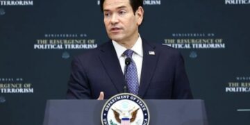
On September 4, 2026, the UN General Assembly voted 164 to 1, with six countries abstaining, in favour of a resolution supporting efforts to correct distortions in conventional world maps and encouraging the use of equal area projections such as Equal Earth. Togo introduced the resolution on behalf of the African Group, backed by the African Union. The United States was the only country to vote against it, describing the initiative as part of a broader ideological project. Estonia, Georgia, Lithuania, Moldova, Serbia, and Ukraine abstained, with Ukraine’s delegation saying its concern was not with Africa’s case but with how Russian-occupied Ukrainian territory appears on some Equal Earth maps.
The resolution is not legally binding. It does not ban the Mercator projection or compel any school, government, or technology company to replace it overnight. It encourages governments and institutions to use projections that more accurately represent the relative size of the world’s regions. But symbolically the vote is enormous, because this is not merely an argument about cartography. It is an argument about how humanity sees itself, and nowhere is that question more politically and psychologically powerful than in Africa.
Look at a conventional Mercator map and something immediately feels wrong once you know the numbers. Greenland can appear comparable in size to Africa. It is not. Africa covers roughly 30.3 million square kilometres. Greenland is about 2.2 million square kilometres. Africa is therefore roughly fourteen times larger than Greenland, yet generations of schoolchildren have looked at maps in which the two appear deceptively similar in size. That is not because Gerardus Mercator secretly decided Africa should look fourteen times smaller. He introduced his projection in 1569, primarily as a tool for navigation, and it was a remarkable achievement because it preserved angles and directions in a way that made it enormously useful to sailors. But there was a price. The farther a landmass lies from the equator, the more its area becomes visually enlarged. Africa sits astride the equator. Greenland lies far to the north. The mathematics produces a dramatic distortion of relative area. The problem is not that Mercator was wrong for the purpose it was designed for. The problem is that a projection built for navigation became one of the most familiar ways generations of people were taught to visualise the entire world. A technical tool became a cultural lens, and a cultural lens can survive long after the circumstances that created it have disappeared.
Most people never studied cartography. They simply trusted the map. A child does not walk into a classroom and ask whether a projection has distorted the relative size of continents. The child assumes the teacher knows, the textbook is correct, and the picture on the wall represents reality. When the same picture appears in atlases, newspapers, television graphics, offices, and government institutions, repetition transforms representation into perception. That is the quiet power of miseducation. It does not always have to tell you what to think. Sometimes it only has to determine what you see first, and it becomes the lens through which everything else is filtered. When new information later challenges that lens, people can struggle not because the truth is complicated but because it disrupts a worldview built long ago. Realising that even your literal picture of the world was distorted forces you to ask what else you took for granted, and admitting that the lens you were given is broken takes real intellectual courage.
There is another distortion far more dangerous than Mercator’s, and that is the idea that African history began when Europeans arrived. It did not. Long before colonialism, African civilisations built cities, kingdoms, trading networks, intellectual traditions and political institutions, from the ancient civilisations of Egypt and Nubia to the kingdoms of Mali, Songhai, Benin, Kongo, Ethiopia and Great Zimbabwe. Gold travelled across African trade routes, salt moved across the Sahara, and textiles, ivory, metals, and agricultural products moved between communities and across regions. Africa was not a space waiting to be discovered. The continent did not enter world history when Europeans arrived. Europe entered a continent that already had one.
The irony is difficult to ignore. A continent sometimes portrayed as backward or peripheral became extraordinarily important whenever the world needed something from beneath its soil. Gold, diamonds, copper, cobalt, uranium, bauxite, platinum, oil, natural gas, iron ore, manganese, timber, cocoa, coffee, cotton, palm oil, and rubber, and increasingly the strategic minerals needed to build the technologies of the future. During the colonial period, European demand for raw materials helped drive deeper penetration into the continent and shaped the political and economic structures of colonial rule. Railways and ports were frequently built around the movement of commodities and minerals rather than the needs of the people living along their routes. Infrastructure followed extraction, wealth moved outward, and African societies were left to negotiate the consequences. By the mid twentieth century, almost the entire continent, with Ethiopia and Liberia retaining their independence, had been brought under European colonial rule. Independence changed the architecture of political power. It did not automatically transform the economic one, and that is why Africa’s resource question remains contentious today.
Africa’s greatest resource has never been only what lies beneath its soil. It is human. The continent is home to the world’s youngest population, and the World Bank projects Africa could reach about 2.5 billion people by 2050, roughly half of them under 25. That demographic weight is one of the defining economic stories of this century, and it is visible in cities that the old map never captured properly either. Lagos has become a fintech powerhouse. Nairobi is known as the Silicon Savannah. Johannesburg remains one of the continent’s major financial centres, and Kigali, Accra, Casablanca, Addis Ababa, Cairo, and Abuja Nigeria each carry their own weight of skylines, universities, research centres, and diplomatic life. Africa is not one country. It is 54 nations, hundreds of millions of people, thousands of languages and societies with radically different political and economic realities, containing megacities and remote villages, financial centres and farming communities, modern airports beside ancient monuments. Some people who grew up outside Africa genuinely believe it is a single country, and that happens partly through ignorance, partly through inadequate education, and partly through the psychological power of repetition. When a child repeatedly sees Africa presented as one undifferentiated territory of wildlife, famine, and conflict, Nigeria disappears, Kenya disappears, Ghana disappears, Egypt disappears, and the continent collapses into a single imagined place. That is not geography. It is mental cartography, and mental maps can be as powerful as physical ones.
But history should not be reduced to a simple story in which every African failure was caused by outsiders. That would be another distortion. Africa has also suffered from internal governance failures, corruption, weak institutions, insecurity, unequal contracts, and poor economic diversification, and the external history of extraction has to be examined alongside the internal history of governance. One cannot honestly tell Africa’s story while pretending only one of them exists.
This is where the map becomes more than a map. For centuries, outsiders have helped define how Africa is seen. But African leaders have also had opportunities to redefine what Africa can become, and too often those opportunities have been squandered. Africa cannot keep exporting raw materials and importing finished products while calling itself resource-rich. It cannot celebrate enormous reserves of oil, gas, gold, and cobalt while millions remain without reliable electricity, quality education, healthcare, and productive employment. It cannot boast about its human capital while its brightest young people keep leaving because the systems at home cannot absorb them. And it cannot demand that the world change its perception of Africa while refusing to change the political and economic realities that feed that perception. The map did not make Africa poor. Colonialism did not create every problem Africa faces today. Changing the map will not solve them either. But neither can Africa afford to ignore the power of representation, because perception shapes investment, diplomacy, education, and political imagination, and it can shape how Africans understand their own possibilities too.
The African Union adopted the Equal Earth projection at its 39th Ordinary Session in April 2026, following a campaign led by the advocacy groups Africa No Filter and Speak Up Africa, and urged member states to review their educational materials accordingly. AU Commission deputy chairperson Selma Malika Haddadi told Reuters that the Mercator projection wrongly makes Africa look marginal despite it being the world’s second-largest continent, and said such stereotypes shape media, education, and policy. That AU decision helped carry the campaign to the United Nations, where Togo formally raised it in April, leading to a draft resolution and informal consultations in July before Friday’s vote. France’s foreign minister announced hours before the vote that Paris would abandon Mercator for its own world maps, a decision that means France itself will appear smaller relative to equatorial countries under the new projection, alongside the United States, Russia, and China. The Equal Earth projection was developed in 2018 by the cartographers Tom Patterson, Bernhard Jenny, and Bojan Šavrič. It is an equal area projection, meaning relative land sizes are represented more accurately, though no flat map can reproduce every property of a sphere perfectly. The objective is not to pretend that one flat map can substitute for a globe. It is to choose the right projection for the question being asked. For navigation, Mercator still has a legitimate purpose. For comparing the true size of continents, an equal area projection is far more appropriate, and that is the real cartographic argument behind the vote.
This is where the story becomes uncomfortable. We have all been given lenses through which we interpret the world, shaped by colonial history, textbooks, television, propaganda, family, geography, privilege, poverty, and simple repetition. The danger of miseducation is not only that it gives you the wrong answer. It can teach you to ask the wrong question. It can make inequality look natural, a continent look insignificant, poverty appear intrinsic, and exploitation disappear behind the language of development. It can make dependency appear inevitable. But correcting the world’s map will not build a hospital, reform a corrupt institution, stop insecurity, create jobs, or convert Africa’s mineral wealth into prosperity on its own. That work belongs to Africans themselves. Africa must do more than demand that the world see the continent correctly. Africa must also learn to see itself correctly, rejecting both the colonial caricature of a hopeless continent and the romantic caricature of one without internal problems, and building the honest journalism, accountable governments, stronger institutions, industrial capacity, and infrastructure that turn natural wealth into human prosperity. The objective cannot simply be to correct the map. It must be to correct the conditions that make the map matter.
For more than four centuries, one of the world’s most familiar projections visually enlarged territories farthest from Africa while compressing the continent around the equator, yet the physical Africa underneath the distortion never changed. Its gold remained underground until somebody extracted it. Its oil remained beneath the earth until somebody drilled for it. Its cobalt remained in the ground until the world needed batteries for the technologies it now depends on. Its talent remained in African minds until the world began recruiting it, and its cities kept growing while the world map stayed the same. The map was distorted. Africa was not. The world has spent centuries drawing Africa. It may be time Africa helped redraw the world, starting with the map, and finishing with the leadership that let the old picture stand unquestioned for so long.
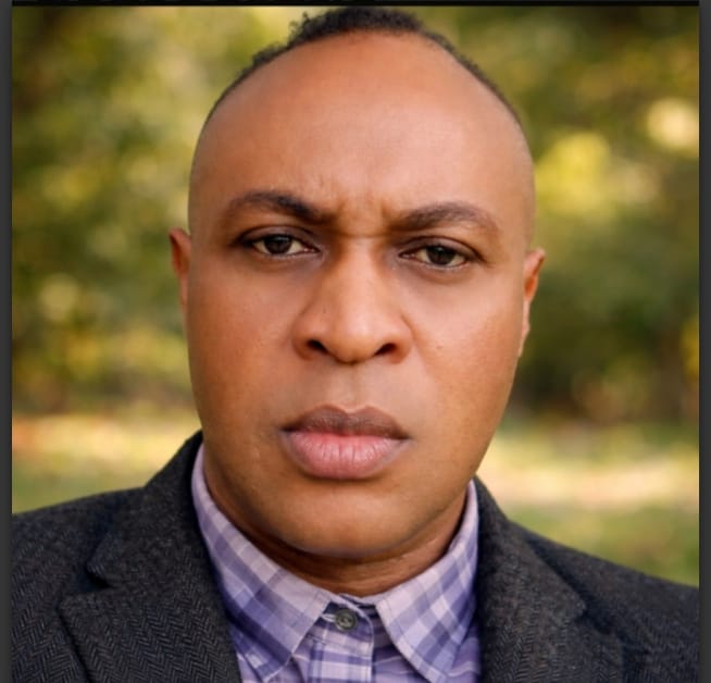
Daniel Nduka Okonkwo is an investigative journalist, human rights advocate, and publisher, and the founder of Profiles International Human Rights Advocate, PIHRA. His work focuses on governance, accountability, and the protection of fundamental rights across Nigeria and Africa. His reporting has appeared in Vanguard, Daily Trust, Sahara Reporters, African Defence Forum, Opinion Nigeria, and Daily Intel, among others.
Read more of his work on the PIHRA blog: https://profilesinternationalhumanrightsadv.blogspot.com
For tips, feedback, or collaboration, reach him at dan.okonkwo.73@gmail.com